This forum is for comments and the exchange of information relating to Trojan Boats and boating. Please do not post used parts or boats For Sale in this area. For general, non-boating topics please use our "General Discussions" section.
Note: Negative or inflammatory postings will not be tolerated.
may not be the latest/greatest but still better technology than what was available when your boat was brand new
RWS
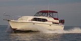
1983 10 Meter SOLD after 21 years of adventures
Yanmar diesels
Solid Glass Hull
Woodless Stringers
Full Hull Liner
Survived Andrew Cat 5,Eye of Charley Cat 4, & Irma Cat 2
Trojan International Website: http://trojanboat.com/
Watch the sales out there . But it may be hard to do for 500 . A package deal with a transducer maybe your best bet ,but many are transom mounts . thru hulls are better on inboards .
Used on ebay is worth looking at . Don't forget about the transducer most used won't have one
Boating is good for the soul
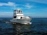
77/78 TROJAN F36 Conv.
6BTA Cummins diesels
Life is to short for a ugly boat
Android tablet w navionics then can use cell phone on your couch to plot trips. This also gives you options for backup devices and upgrades. Navionics also has a transducer you can add for sonar/ fishfinder uses a vpn wifi signal rubs about 150.00 and the chart annuals are like 15.00 so add your tablet for another 100.00 and your set.
While I think these phone/pads devices have there place and are a good back up , I don't believe they are as good as a real MFD or chart plotter . People that have them I know will use them away from the helm and use the real deal while piloting . I have seen them lock up too .
Most are not water proof/ shake proof and it a boat what could go wrong lol
Boating is good for the soul
77/78 TROJAN F36 Conv.
6BTA Cummins diesels
Life is to short for a ugly boat
My Garmin 740s comes with a disclaimer that won't let it start working until you agree that the thing is worthless.
OK, so it doesn't exactly say that in so many words, but the essence is that Garmin, a formerly US company that moved to Ireland to avoid supporting America with its taxes, is not responsible if its stuff is wrong.
I needed a less expensive hobby, so I bought a boat!
P-Dogg wrote: ↑Sat Jun 20, 2020 9:53 pm
My Garmin 740s comes with a disclaimer that won't let it start working until you agree that the thing is worthless.
OK, so it doesn't exactly say that in so many words, but the essence is that Garmin, a formerly US company that moved to Ireland to avoid supporting America with its taxes, is not responsible if its stuff is wrong.
Not a fan of Garmin I see . I don't know much about where they pay taxes , I do know they make a great product and the Support is great and they are world wide . while your 740s is a bit dated it is a very good unit . I have a 741xs the update/replacement its faster , has wifi and can network with Garmin other units . Of course NMEA 2000 like the 740.. I also have a 1040xs . Of course they also are dated but work great . My friend ( with deep pockets) was so impressed with the 741 , That he replaced his Raymarine with Garmin last year . Of course not with a 741 ,but the latest 15" MFD and open array . I wish I can afford that amazing unit ! But I am enjoying his old 12" MFD and radar . It also has a chartploter/GPS but it soooooo slow ,I don't use it .
Of course there are other good brands out there and all are not responsible for errors .
Boating is good for the soul
77/78 TROJAN F36 Conv.
6BTA Cummins diesels
Life is to short for a ugly boat
My primary navigation is on an Android tablet running Navionics. The chartplotter displays radar, trip data and gauges. With a wifi connection to the NMEA 2000 network, system data like depth, heading and such is available and displayed on the tablet. The main reason I use the tablet for navigation is that the screen is larger. Other than the fact it is connected via wifi, it can do just about anything the chartplotter can, as long as the chartplotter is turned on.
.
Controls - Finished.jpg (83.41 KiB) Viewed 10894 times
WayWeGo wrote: ↑Mon Jun 22, 2020 10:12 pm
My primary navigation is on an Android tablet running Navionics. The chartplotter displays radar, trip data and gauges. With a wifi connection to the NMEA 2000 network, system data like depth, heading and such is available and displayed on the tablet. The main reason I use the tablet for navigation is that the screen is larger. Other than the fact it is connected via wifi, it can do just about anything the chartplotter can, as long as the chartplotter is turned on.
So I assume the chartplotter is the brains ?
Boating is good for the soul
77/78 TROJAN F36 Conv.
6BTA Cummins diesels
Life is to short for a ugly boat
WayWeGo wrote: ↑Mon Jun 22, 2020 10:12 pm
My primary navigation is on an Android tablet running Navionics. The chartplotter displays radar, trip data and gauges. With a wifi connection to the NMEA 2000 network, system data like depth, heading and such is available and displayed on the tablet. The main reason I use the tablet for navigation is that the screen is larger. Other than the fact it is connected via wifi, it can do just about anything the chartplotter can, as long as the chartplotter is turned on.
So I assume the chartplotter is the brains ?
Not really, but it is the primary source of system data (heading, AIS, depth, etc.) that the tablet is using, other than the actual charts and GPS.